Vila Real District (Distrito de Vila Real)
Vila Real is a rugged area of low mountains and narrow valleys. Historically it had always been cut off from the coast by the Marão, Gerês, and Cabreira mountains until a highway was cut through in the eighties. Due to poor soil, agriculture has always been a struggle, although wine grapes are produced in the south near the Douro River. Potatoes, corn, and rye have always been the traditional crops, as well as limited dairy farming. Extensive areas are covered in pine forest. Granite and the manufacture of mineral water—the waters of Vidago and Pedras Salgadas are nationally famous—are two important industries.
There was formerly a narrow gauge railway (the Corgo line) which linked the town of Vila Real with Peso da Régua on the Douro River. Until 1990 the railway reached as far north as Chaves. The remaining, southern part of the Corgo line closed in 2009.
Map - Vila Real District (Distrito de Vila Real)
Map
Country - Portugal
 |
 |
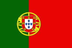
| Flag of Portugal | |
One of the oldest countries in Europe, its territory has been continuously settled, invaded and fought over since prehistoric times. The territory was first inhabited by pre-Roman and Celtic peoples who had contact with Phoenicians, ancient Greeks and Carthaginians. It was later ruled by the Romans, followed by the invasions of Germanic peoples and the Islamic invasion by the Moors, whose rule was eventually expelled during the Reconquista. Founded first as a county of the Kingdom of León in 868, gained its independence as the Kingdom of Portugal with the Treaty of Zamora in 1143.
Currency / Language
| ISO | Currency | Symbol | Significant figures |
|---|---|---|---|
| EUR | Euro | € | 2 |
| ISO | Language |
|---|---|
| PT | Portuguese language |


