Saint Kitts and Nevis (Federation of Saint Kitts and Nevis)
 |
 |
| Flag of Saint Kitts and Nevis | |
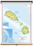
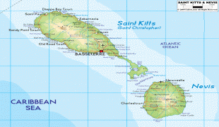
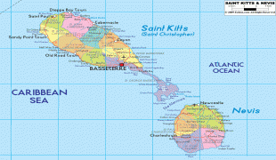
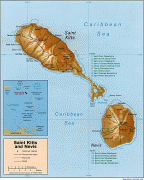
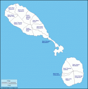
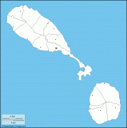
The capital city is Basseterre, located on the larger island of Saint Kitts. Basseterre is also the main port for passenger entry (via cruise ships) and cargo. The smaller island of Nevis lies approximately 3 km to the southeast of Saint Kitts, across a shallow channel called The Narrows.
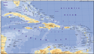
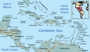
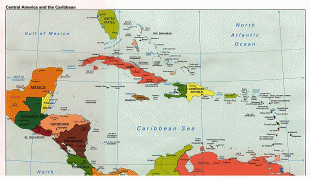
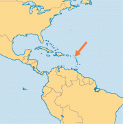
The British dependency of Anguilla was historically also a part of this union, which was known collectively as Saint Christopher-Nevis-Anguilla. However, Anguilla chose to secede from the union, and remains a British overseas territory. The islands of Sint Eustatius, Saba, Saint Barthélemy, Saint-Martin/Sint Maarten and Anguilla lie to the north-northwest of the country. To the east and northeast are Antigua and Barbuda, and to the southeast is the small uninhabited island of Redonda (part of Antigua and Barbuda) and the island of Montserrat.
Saint Kitts and Nevis were among the first islands in the Caribbean to be colonised by Europeans. Saint Kitts was home to the first British and French Caribbean colonies, and thus has also been titled "The Mother Colony of the West Indies". It is also the most recent British territory in the Caribbean to become independent, gaining independence in 1983.
The Kalinago, the pre-European inhabitants of Saint Kitts, called the island Liamuiga, roughly translating as "fertile land".
It is thought that Christopher Columbus, the first European to see the islands in 1493, named the larger island San Cristóbal, after Saint Christopher, his patron saint and that of travellers. New studies suggest that Columbus named the island Sant Yago (Saint James), and that the name San Cristóbal was in fact given by Columbus to the island now known as Saba, 20 mi northwest. Saint Kitts was well documented as San Cristóbal by the 17th century. The first English colonists kept the English translation of this name, and dubbed it St. Christopher's Island. In the 17th century, a common nickname for Christopher was Kit(t); hence, the island came to be informally referred to as Saint Kitt's Island, later further shortened to Saint Kitts.
Columbus gave Nevis the name San Martín (Saint Martin). The current name Nevis is derived from a Spanish name Nuestra Señora de las Nieves, meaning "Our Lady of the Snows", a reference to the 4th-century Catholic miracle of a summertime snowfall on the Esquiline Hill in Rome. It is not known who chose this name for the island, but it is thought that white clouds which usually wreath the top of Nevis Peak reminded someone of the miracle.
Today, the Constitution refers to the state as both Saint Kitts and Nevis and Saint Christopher and Nevis; the former is the one most commonly used, but the latter is generally used for diplomatic relations.
Currency / Language
| ISO | Currency | Symbol | Significant figures |
|---|---|---|---|
| XCD | East Caribbean dollar | $ | 2 |
| ISO | Language |
|---|---|
| EN | English language |