Nicosia District (Nicosia District)
Nicosia District (Greek: Eπαρχία Λευκωσίας) is one of the six districts of Cyprus. Its main town is the island country's capital city, Nicosia. The TRNC-controlled northern part of the district is the Lefkoşa District of the unrecognized Turkish Republic of Northern Cyprus.
TRNC-controlled areas of the Larnaca District of the Republic of Cyprus are administered as part of Nicosia District, while western parts of the Nicosia District under de facto TRNC control are administered as part of the new Güzelyurt and Lefke Districts.
Under Lusignan rule, at least the latter part and then during the Venetian period, the Kingdom of Cyprus was divided into eleven provinces called in French contrées and in Italian contrade. The area around Nicosia was the province of Vicomté (literally the domain of a Viscount). It covered the eastern half of the present District of Nicosia, what would later become the Nahiehs of Dagh and Deyirmenlik (orange on map). The western half of the present district formed the province of Pendaïa (Pendagia). One significant difference in the borders was that Vicomté extended closer to the sea, encroaching upon the Pentadaktylos foothills in the present Kyrenia District.
Under Ottoman Turkish rule, Nicosia was one of the six cazas into which the island was divided. The Caza of Nicosia, also known as the Caza of Deyirmenlik, was divided into two nahiehs - Dagh (Orini) and Deyirmenlik (Kythrea). The caza was headed by a Kaimakan. When the British took control of Cyprus in 1878, these administrative units were retained. A British officer styled a Commissioner (later District Officer) was appointed for the caza of Nicosia, while the Turkish Kaimakan was initially retained with certain of his functions.
The Nahiehs of Lefka and Morphou were previously in the Caza of Kyrenia. But by 1881, the Nahiehs of the Caza of Nicosia were: The town of Nicosia, previously separate, came under the Nahieh of Deyirmenlik (Greek: Kythrea) in the British period.
* Lefka
* Morphou
* Dagh
* Deyirmenlik
Map - Nicosia District (Nicosia District)
Map
Country - Cyprus
 |
 |
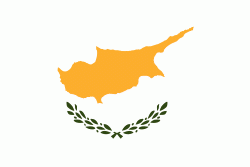
| Flag of Cyprus | |
The earliest known human activity on the island dates to around the 10th millennium BC. Archaeological remains include the well-preserved ruins from the Hellenistic period such as Salamis and Kourion, and Cyprus is home to some of the oldest water wells in the world. Cyprus was settled by Mycenaean Greeks in two waves in the 2nd millennium BC. As a strategic location in the Eastern Mediterranean, it was subsequently occupied by several major powers, including the empires of the Assyrians, Egyptians and Persians, from whom the island was seized in 333 BC by Alexander the Great. Subsequent rule by Ptolemaic Egypt, the Classical and Eastern Roman Empire, Arab caliphates for a short period, the French Lusignan dynasty and the Venetians was followed by over three centuries of Ottoman rule between 1571 and 1878 (de jure until 1914).
Currency / Language
| ISO | Currency | Symbol | Significant figures |
|---|---|---|---|
| EUR | Euro | € | 2 |
| ISO | Language |
|---|---|
| EN | English language |
| EL | Greek language |
| TR | Turkish language |


