L-Għarb
 |
 |
Għarb started as a small hamlet which developed around the middle ages. The word Għarb is the Arabic word for West, so it should be no surprise that the village is the most westerly place on Gozo. One can see its ancient roots in the centre of the village where some houses have fine examples of decorated stone balconies. Għarb was created as a parish in 1679, a move which gave impetus for the building of a new, baroque parish church. Built between 1699 and 1729, it has an elegant façade which has been compared with Francesco Borromini's Church of Saint Agnes in Piazza Navona, Rome. The village square, so quintessentially Gozitan, has become the view on many a postcard. On the square is a folklore museum housing all sorts of memorabilia retelling the Islands' rural history. Għarb lies in some of Gozo's most scenic countryside, particularly at Dbieġi, the highest hill on the Island. Also at Dbieġi is a centre for Gozitan crafts. Within the limits of Għarb is the Chapel of San Dimitri. According to legend, the first chapel was built on the cliff side by a woman whose son was freed from captivity by St. Demetrius. Also nearby is the Basilica ta' Pinu, Malta's pre-eminent shrine to the Virgin Mary. It was on this spot in 1883, that a local woman heard the voice of the Virgin. The parish church is dedicated to the visitation of Saint Mary to her cousin Saint Elizabeth. The late Karmni Grima and Frenċ tal-Għarb are two of its most renowned villagers.
Map - L-Għarb
Map


Country - Malta
 |
 |
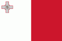
| Flag of Malta | |
Malta has been inhabited since approximately 5900 BC. Its location in the centre of the Mediterranean has historically given it great strategic importance as a naval base, with a succession of powers having contested and ruled the islands, including the Phoenicians and Carthaginians, Romans, Greeks, Arabs, Normans, Aragonese, Knights of St. John, French, and British, amongst others.
Currency / Language
| ISO | Currency | Symbol | Significant figures |
|---|---|---|---|
| EUR | Euro | € | 2 |
| ISO | Language |
|---|---|
| EN | English language |
| MT | Maltese language |
