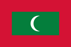
The Maldives (, ; ދިވެހިރާއްޖެ, ), officially the Republic of Maldives (ދިވެހިރާއްޖޭގެ ޖުމްހޫރިއްޔާ, ), is an archipelagic state in South Asia, situated in the Indian Ocean. It lies southwest of Sri Lanka and India, about 750 km from the Asian continent's mainland. The Maldives' chain of 26 atolls stretches across the equator from Ihavandhippolhu Atoll in the north to Addu Atoll in the south.
Comprising a territory spanning roughly 90,000 km2 including the sea, land area of all the islands comprises 298 km2, the Maldives is one of the world's most geographically dispersed sovereign states and the smallest Asian country as well as one of the smallest Muslim-majority countries by land area and, with around 557,751 inhabitants, the 2nd least populous country in Asia. Malé is the capital and the most populated city, traditionally called the "King's Island" where the ancient royal dynasties ruled for its central location.


