Danilovgrad
 |
The town of Danilovgrad is located in the Bjelopavlići plain, a fertile valley of the Zeta River. It is the centre of the Danilovgrad municipality, which has a population of 18,472.
In the surroundings of Danilovgrad, there are remains of Gradina (Martinići), dating back to the time of the Serbian ruler Petar Gojniković, from the Vlastimirović dynasty. The court was built by another member of the dynasty, prince Mutimir, who was also once buried in there. Gradina is also a prominent seat from the Nemanjić period, believed to be the birthplace of Rastko Nemanjić, also known as Saint Sava, the founder of the Serbian Orthodox Church.
Danilovgrad was founded with the purpose of being the capital of Montenegro. Foundations for this planned city were first laid by King Nikola I in 1870. However, after the cities of Nikšić and Podgorica were liberated from Ottoman hands, during the Congress of Berlin, its significance diminished. It was named after Nicholas' predecessor, Prince Danilo.
Map - Danilovgrad
Map
Country - Montenegro
 |
 |
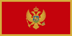
| Flag of Montenegro | |
During the Early Medieval period, three principalities were located on the territory of modern-day Montenegro: Duklja, roughly corresponding to the southern half; Travunia, the west; and Rascia proper, the north. The Principality of Zeta emerged in the 14th and 15th centuries. From the late 14th century to the late 18th century, large parts of southern Montenegro were ruled by the Venetian Republic and incorporated into Venetian Albania. The name Montenegro was first used to refer to the country in the late 15th century. After falling under Ottoman Empire rule, Montenegro gained its semi-autonomy in 1696 under the rule of the House of Petrović-Njegoš, first as a theocracy and later as a secular principality. Montenegro's independence was recognised by the Great Powers at the Congress of Berlin in 1878. In 1910, the country became a kingdom.
Currency / Language
| ISO | Currency | Symbol | Significant figures |
|---|---|---|---|
| EUR | Euro | € | 2 |
| ISO | Language |
|---|---|
| SQ | Albanian language |
| BS | Bosnian language |
| HR | Croatian language |
| HU | Hungarian language |
| SR | Serbian language |


