Colihaut
Colihaut is a coastal village in northern Dominica within Saint Peter Parish midway between the towns of Roseau and Portsmouth. It has a population of 773 people.
Colihaut Beach is primarily gray sand with smooth waters runs along the coastal edge of the town flanked by mountain ranges.
The conservation of Colihaut natural resources is essential for ecological value and economic prosperity.
Majority of Colihaut inhabitants are earning their living in quarrying operations alongside or fishing activities. Quarries in Colihaut are managed by West Indies Aggregate Ltd (WIA), operated by Jacques Gaddarkhan.
A primary school, sports field, day nursery, post office, credit union, Village Council, health center and four Christian churches provide services to villagers. Residents earn a living mainly through agriculture and fishing. Secondary school graduates work for government and the private sector in Roseau. The young people who do not proceed to secondary school either emigrate, are unemployed or underemployed. A large percentage of the village's income however comes from remittances from family abroad.
In August 2015, Tropical Storm Erika battered Dominica. Heavy rains led to massive flooding, causing many homes on the river bank to leave their foundations. The buildings that remained in place became conduits for the river that breached its banks. Mud, silt and rubble filled the roads to a depth of many feet making travel by car or truck impossible. First responders had to use boats to assess the situation and offer aid.
Due to the storm Colihaut Primary School remained closed due to damage and lack of water well into the school year. Students were forced to commute to another school (Dublanc Primary School) and participate in a shift system where they were schooled for only a half day.
Map - Colihaut
Map
Country - Dominica
 |
 |
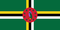
| Flag of Dominica | |
The island was settled by the Arawak arriving from South America in the fifth century. The Kalinago displaced the Arawak by the 15th century. Columbus is said to have passed the island on Sunday, 3 November 1493. It was later colonised by Europeans, predominantly by the French from the 1690s to 1763. The French imported enslaved people from West Africa to Dominica to work on coffee plantations. Great Britain took possession in 1763 after the Seven Years' War, and it gradually established English as its official language. The island gained independence as a republic in 1978.
Currency / Language
| ISO | Currency | Symbol | Significant figures |
|---|---|---|---|
| XCD | East Caribbean dollar | $ | 2 |
| ISO | Language |
|---|---|
| EN | English language |


