Camagüey (Provincia de Camagüey)
 |
It was founded as Santa María del Puerto del Príncipe in 1514, by Spanish colonists on the northern coast and moved inland in 1528, to the site of a Taino village named Camagüey. It was one of the seven original settlements (villas) founded in Cuba by the Spanish. After Henry Morgan burned the city in the 17th century, it was redesigned like a maze so attackers would find it hard to move around inside the city.
The symbol of the city of Camagüey is the clayen pot or tinajón, used to capture rain water and keep it fresh. Camagüey is also the birthplace of Ignacio Agramonte (1841), an important figure of the Ten Years' War against Spain. A monument by Italian sculptor Salvatore Buemi, erected in the center of the area to Ignacio Agramonte, was unveiled by his wife in 1912. It is composed of an equestrian statue, reliefs in bronze that reveal fragments of the life of Agramonte, and a sculpture of a woman that symbolizes the motherland.
In July 2008, the old town was designated a UNESCO World Heritage Site, because of its irregular, maze-like city planning, its prominent role in early Spanish colonization and agriculture, and its rich architecture showing a variety of influences.
Camagüey was founded as Santa María del Puerto del Príncipe in 1514, by Spanish colonists led by Diego Velázquez de Cuéllar at a location now known as Nuevitas on the northern coast. It was one of the seven original settlements (villas) founded in Cuba by the Spanish. The settlement was moved inland in 1528 to the site of a Taíno village named Camagüey.
Between 1747 and 1753 Luis de Unzaga, then Captain Governor of Puerto Principe, rehabilitated the town, which was very deteriorated in the War of Jenkins' Ear, and Unzaga rebuilt the church of La Merced.
It was in 1898 when it received the current name of Camagüey, as a result of Spain's independence. The indigenous name was already used to refer to the region "El Camagüey" in reference to the local chief ('Cacique') Camagüebax, who exercised his command between the Tínima and Hatibonico rivers and was approved on that date for both the city and the province that had been created in 1878 as a military region for the republic in arms.
The new city was built with a confusing lay-out of winding alleys. There are many blind alleys and forked streets that lead to squares of different sizes. One explanation is that this was done by design, to make the city easier to defend from any raiders; by the same version, the reason that there is only one exit from the city was that should pirates ever return and succeed in entering the city, it would be possible for local inhabitants to entrap and kill them. However, locals dispute this reasoning as a myth, asserting that in truth the city developed without planning, and that winding streets developed out of everybody wanting to stay close to their local church (the city has 15 of them).
Map - Camagüey (Provincia de Camagüey)
Map
Country - Cuba
 |
 |
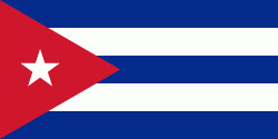
| Flag of Cuba | |
The territory that is now Cuba was inhabited by the Ciboney people from the 4th millennium BC with the Guanahatabey and Taíno peoples until Spanish colonization in the 15th century. From the 15th century, it was a colony of Spain, and slavery was abolished in 1886, remaining a Spanish colony until the Spanish–American War of 1898, when Cuba was occupied by the United States and gained independence in 1902. In 1940, Cuba implemented a new constitution, but mounting political unrest culminated in a coup in 1952 and the subsequent dictatorship of Fulgencio Batista, which was later overthrown in January 1959 by the 26th of July Movement during the Cuban Revolution, which afterwards established communist rule under the leadership of Fidel Castro. The country was a point of contention during the Cold War between the Soviet Union and the United States, and a nuclear war nearly broke out during the Cuban Missile Crisis of 1962. Following the collapse of the Soviet Union, Cuba faced a severe economic downturn in the 1990s, known as the Special Period. In 2008, Fidel Castro resigned after 49 years of leadership of Cuba and was replaced by his brother Raúl Castro.
Currency / Language
| ISO | Currency | Symbol | Significant figures |
|---|---|---|---|
| CUC | Cuban convertible peso | $ | 2 |
| CUP | Cuban peso | $ | 2 |
| ISO | Language |
|---|---|
| ES | Spanish language |


