Béchar Province (Wilaya de Béchar)
The greater part of the province is dry plains (hamadas) suitable for grazing but with insufficient surface water to support agriculture. Most settlements are therefore concentrated in oases along the Saoura valley and its tributaries. Natural resources include coal deposits in the north around Bechar and Kenadsa.
The oases' traditional economic basis was agriculture, notably growing date palms and grain. The inhabitants of several oases, notably Ouakda, Lahmar and Boukais, speak Berber languages, while the rest speak Arabic. Many of the oases had significant populations of shurfa or Haratin peoples. There is a notable zaouia (traditional religious school) at Kenadsa. The region also supported a substantial mainly Arab pastoralist nomadic population, notably the Doui-Menia and Ouled Djerir; most or all have settled in the oases.
Trans-Saharan trade routes passing through this region played an important role in its economy in pre-modern times, but have at present been superseded. A small tourism industry exists, focused particularly on Taghit. Béchar, whose growth from a minor village began only in the early 20th century, has become the principal urban and administrative centre.
The region has a distinctive musical scene influenced by sub-Saharan African rhythms, whose best known representative is the Gnawi singer Hasna El Becharia. Another locally well-known group is El Sed, from Kenadsa.
Disagreements between Morocco and Algeria over their mutual border in this province and Tindouf led to conflict after Algeria's independence, the so-called Sand War.
The province was created from the Saoura department in 1974. In 1984 Tindouf Province was carved out of its territory. In 2019 Béni Abbès Province followed.
Map - Béchar Province (Wilaya de Béchar)
Map
Country - Algeria
 |
|
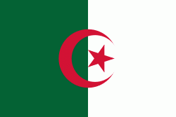
| Flag of Algeria | |
Algeria produced and is linked to many civilizations, empires and dynasties, including ancient Numidians, Phoenicians, Carthaginians, Romans, Vandals, Byzantines, Umayyads, Abbasids, Rustamids, Idrisids, Aghlabids, Fatimids, Zirids, Hammadids, Almoravids, Almohads, Zayyanids, Spaniards, Ottomans and the French colonial empire, with the latter expanded into its present-boundaries. After 132 years of being part of France, tensions between France and the local Algerian populace led to the start of the Algerian War which concluded with Algeria obtaining its independence on 5 July 1962 with the establishment of the People's Democratic Republic on 20 September of that year.
Currency / Language
| ISO | Currency | Symbol | Significant figures |
|---|---|---|---|
| DZD | Algerian dinar | دج | 2 |
| ISO | Language |
|---|---|
| AR | Arabic language |


