Betty's Hope (Betty’s Hope)
Betty's Hope was a sugarcane plantation in Antigua. It was established in 1650, shortly after the island had become an English colony, and flourished as a successful agricultural industrial enterprise during the centuries of slavery. It was the first large-scale sugar plantation to operate in Antigua and belonged to the Codrington family from 1674 until 1944. Christopher Codrington, later Captain General of the Leeward Islands, acquired the property in 1674 and named it Betty's Hope, after his daughter.
Betty's Hope is no longer operational as a plantation. However, the structures pictured here at the time of restoration works initiated by the Government of Antigua and Barbuda in 1990, under the OEC/ESDU Eco-Tourism Enhancement project, consisted of the twin windmills, the Cistern Complex in serviceable condition, the Great House (Buff or Estate House) in ruins, the Boiling House where sixteen copper hoppers were used to boil cane juice to produce crystalline sugar, and the Still House, a distillery used for manufacturing rum (also seen in ruins without a roof but with elegant arches). Since 1995, the buildings have been developed as an open-air museum with a visitor center and are managed by the Museum of Antigua and Barbuda.
Betty's Hope estate is in a rural area where the geological formation, in a rolling landscape, is limestone. Its location is at 17.08097°N, -61.74563°W, to the south of the town of Pares.
Map - Betty's Hope (Betty’s Hope)
Map
Country - Antigua_and_Barbuda
 |
 |
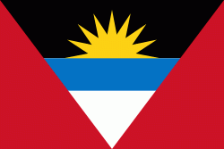
| Flag of Antigua and Barbuda | |
The country consists of two major islands, Antigua and Barbuda, which are approximately 40 km apart, and several smaller islands, including Great Bird, Green, Guiana, Long, Maiden, Prickly Pear, York, and Redonda. The permanent population is approximately 97,120 ( estimates), with 97% residing in Antigua. St. John's, Antigua, is the country's capital, major city, and largest port. Codrington is Barbuda's largest town.
Currency / Language
| ISO | Currency | Symbol | Significant figures |
|---|---|---|---|
| XCD | East Caribbean dollar | $ | 2 |
| ISO | Language |
|---|---|
| EN | English language |


