Azores
 |
 |
Its main industries are agriculture, dairy farming, livestock, fishing, and tourism, which has become a major service activity in the region. The government of the Azores employs a large percentage of the population directly or indirectly in the service and tertiary sectors. The largest city of the Azores is Ponta Delgada. The culture, dialect, cuisine, and traditions of the Azorean islands vary considerably, because these remote islands were settled sporadically over a span of two centuries.
There are nine major Azorean islands and an islet cluster, in three main groups. These are Flores and Corvo, to the west; Graciosa, Terceira, São Jorge, Pico, and Faial in the centre; and São Miguel, Santa Maria, and the Formigas islets to the east. They extend for more than 600 km and lie in a northwest–southeast direction. All of the islands have volcanic origins, although some, such as Santa Maria, have had no recorded activity in the time since the islands were settled several centuries ago. Mount Pico, on the island of Pico, is the highest point in Portugal, at 2351 m. If measured from their base at the bottom of the ocean to their peaks, which thrust high above the surface of the Atlantic, the Azores are among the tallest mountains on the planet.
The climate of the Azores is very mild for such a northerly location, being influenced by its distance from the continents and by the passing Gulf Stream. Because of the marine influence, temperatures remain mild year-round. Daytime temperatures normally fluctuate between 16 and 25 C depending on season. Temperatures above 30 C or below 3 C are unknown in the major population centres. It is also generally wet and cloudy.
A small number of alleged hypogea (underground structures carved into rocks) have been identified on the islands of Corvo, Santa Maria, and Terceira by Portuguese archaeologist Nuno Ribeiro, who speculated that they might date back 2,000 years, implying a human presence on the island before the Portuguese. These structures have been used by settlers in the Azores to store grain and the suggestion by Ribeiro that they might be burial sites is unconfirmed. Detailed examination and dating to authenticate the validity of these speculations is lacking; thus it is unclear whether these structures are natural or human-made and whether they predate the 15th century Portuguese colonization of the Azores.
According to a 2015 paper published in Journal of Evolutionary Biology, research based on mouse mitochondrial DNA points to a Scandinavian rather than Portuguese origin of the local mouse population. Some years later, a 2021 paper published in Proceedings of the National Academy of Sciences, using data from lake sediment core sampling suggests brush-clearing was undertaken and animal husbandry introduced between 700 and 850 C.E. Together, these findings suggest a brief period of Norse settlement and the 2021 paper further cites climate simulations carried out that suggest the dominant winds in the North Atlantic Ocean in that period blew from the northeast, which would have taken Viking ships heading southwest from Scandinavia more or less directly to the Azores.
Map - Azores
Map
Country - Portugal
 |
 |
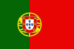
| Flag of Portugal | |
One of the oldest countries in Europe, its territory has been continuously settled, invaded and fought over since prehistoric times. The territory was first inhabited by pre-Roman and Celtic peoples who had contact with Phoenicians, ancient Greeks and Carthaginians. It was later ruled by the Romans, followed by the invasions of Germanic peoples and the Islamic invasion by the Moors, whose rule was eventually expelled during the Reconquista. Founded first as a county of the Kingdom of León in 868, gained its independence as the Kingdom of Portugal with the Treaty of Zamora in 1143.
Currency / Language
| ISO | Currency | Symbol | Significant figures |
|---|---|---|---|
| EUR | Euro | € | 2 |
| ISO | Language |
|---|---|
| PT | Portuguese language |


