Antigua and Barbuda (Antigua and Barbuda)
 |
 |
| Flag of Antigua and Barbuda | |
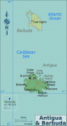
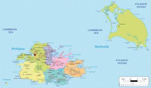
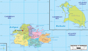
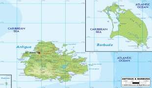
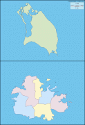
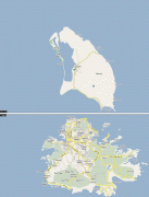
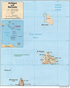
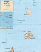
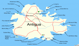
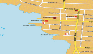
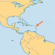
The country consists of two major islands, Antigua and Barbuda, which are approximately 40 km apart, and several smaller islands, including Great Bird, Green, Guiana, Long, Maiden, Prickly Pear, York, and Redonda. The permanent population is approximately 97,120 ( estimates), with 97% residing in Antigua. St. John's, Antigua, is the country's capital, major city, and largest port. Codrington is Barbuda's largest town.
In 1493, Christopher Columbus surveyed the island of Antigua, which he named for the Church of Santa María La Antigua. Great Britain colonized Antigua in 1632 and Barbuda in 1678. A part of the Federal Colony of the Leeward Islands from 1871, Antigua and Barbuda joined the West Indies Federation in 1958. With the breakup of the federation in 1962, it became one of the West Indies Associated States in 1967. Following a period of internal self-governance, it gained full independence from the United Kingdom on 1 November 1981. Antigua and Barbuda is a member of the Commonwealth and a Commonwealth realm; it is a constitutional monarchy with Charles III as its head of state.
The economy of Antigua and Barbuda is largely dependent on tourism, which accounts for 80% of its GDP. Like other island nations, Antigua and Barbuda is vulnerable to the effects of climate change, such as sea level rise, and increased intensity of extreme weather like hurricanes. These cause coastal erosion, water scarcity, and other challenges.
Antigua and Barbuda offers a citizenship by investment program. The country levies no personal income tax.
Antigua is Spanish for 'ancient' and barbuda is Spanish for 'bearded'. The island of Antigua was originally called Wadadli by the Arawaks and is locally known by that name today; the Caribs possibly called Barbuda Wa'omoni. Christopher Columbus, while sailing by in 1493, may have named it Santa Maria la Antigua, after an icon in the Spanish Seville Cathedral. The "bearded" of Barbuda is thought to refer either to the male inhabitants of the island, or the bearded fig trees present there.
Currency / Language
| ISO | Currency | Symbol | Significant figures |
|---|---|---|---|
| XCD | East Caribbean dollar | $ | 2 |
| ISO | Language |
|---|---|
| EN | English language |