Antarctica
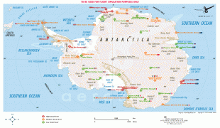
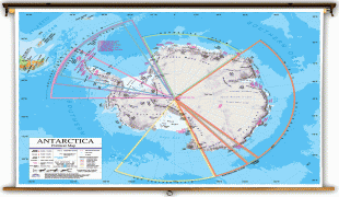
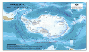
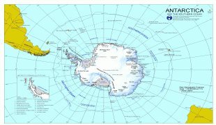
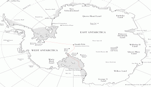
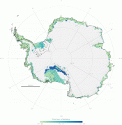
Antarctica is Earth's southernmost and least-populated continent. Situated almost entirely south of the Antarctic Circle and surrounded by the Southern Ocean (also known as the Antarctic Ocean), it contains the geographic South Pole. Antarctica is the fifth-largest continent, being about 40% larger than Europe, and has an area of 14200000 km2. Most of Antarctica is covered by the Antarctic ice sheet, with an average thickness of 1.9 km.
Antarctica is, on average, the coldest, driest, and windiest of the continents, and it has the highest average elevation. It is mainly a polar desert, with annual precipitation of over 200 mm along the coast and far less inland. About 70% of the world's freshwater reserves are frozen in Antarctica, which, if melted, would raise global sea levels by almost 60 m. Antarctica holds the record for the lowest measured temperature on Earth, −89.2 C. The coastal regions can reach temperatures over 10 C in summer. Native species of animals include mites, nematodes, penguins, seals and tardigrades. Where vegetation occurs, it is mostly in the form of lichen or moss.
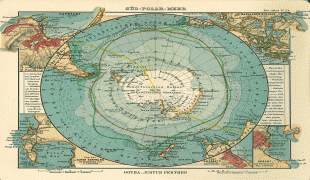
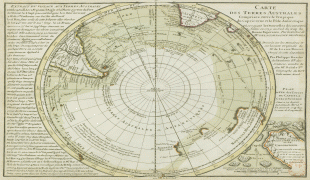
The ice shelves of Antarctica were probably first seen in 1820, during a Russian expedition led by Fabian Gottlieb von Bellingshausen and Mikhail Lazarev. The decades that followed saw further exploration in French, American, and British expeditions. The first confirmed landing was by a Norwegian team in 1895. In the early 20th century, there were a few expeditions into the interior of the continent. British explorers were the first to reach the magnetic South Pole in 1909, and the geographic South Pole was first reached in 1911 by Norwegian explorers.
Antarctica is governed by about 30 countries, all of which are parties of the 1959 Antarctic Treaty System. According to the terms of the treaty, military activity, mining, nuclear explosions, and nuclear waste disposal are all prohibited in Antarctica. Tourism, fishing and research are the main human activities in and around Antarctica. During the summer months, about 5,000 people reside at research stations, a figure that drops to around 1,000 in the winter. Despite its remoteness, human activity has a significant impact on the continent via pollution, ozone depletion, and climate change.
The name given to the continent originates from the word antarctic, which comes from Middle French antartique or antarctique ('opposite to the Arctic') and, in turn, the Latin antarcticus ('opposite to the north'). Antarcticus is derived from the Greek ἀντι- ('anti-') and ἀρκτικός ('of the Bear', 'northern'). The Greek philosopher Aristotle wrote in Meteorology about an "Antarctic region" in c. 350 BCE. The Greek geographer Marinus of Tyre reportedly used the name in his world map from the second century CE, now lost. The Roman authors Gaius Julius Hyginus and Apuleius used for the South Pole the romanised Greek name polus antarcticus, from which derived the Old French pole antartike (modern pôle antarctique) attested in 1270, and from there the Middle English pol antartik, found first in a treatise written by the English author Geoffrey Chaucer.
Belief by Europeans in the existence of a Terra Australis—a vast continent in the far south of the globe to balance the northern lands of Europe, Asia, and North Africa—had existed as an intellectual concept since classical antiquity. The belief of such a land lasted until the discovery of Australia.
During the early 19th century, explorer Matthew Flinders doubted the existence of a detached continent south of Australia (then called New Holland) and thus advocated for the "Terra Australis" name to be used for Australia instead. In 1824, the colonial authorities in Sydney officially renamed the continent of New Holland to Australia, leaving the term "Terra Australis" unavailable as a reference to Antarctica. Over the following decades, geographers used phrases such as "the Antarctic Continent". They searched for a more poetic replacement, suggesting names such as Ultima and Antipodea. Antarctica was adopted in the 1890s, with the first use of the name being attributed to the Scottish cartographer John George Bartholomew.
Antarctica is, on average, the coldest, driest, and windiest of the continents, and it has the highest average elevation. It is mainly a polar desert, with annual precipitation of over 200 mm along the coast and far less inland. About 70% of the world's freshwater reserves are frozen in Antarctica, which, if melted, would raise global sea levels by almost 60 m. Antarctica holds the record for the lowest measured temperature on Earth, −89.2 C. The coastal regions can reach temperatures over 10 C in summer. Native species of animals include mites, nematodes, penguins, seals and tardigrades. Where vegetation occurs, it is mostly in the form of lichen or moss.
The ice shelves of Antarctica were probably first seen in 1820, during a Russian expedition led by Fabian Gottlieb von Bellingshausen and Mikhail Lazarev. The decades that followed saw further exploration in French, American, and British expeditions. The first confirmed landing was by a Norwegian team in 1895. In the early 20th century, there were a few expeditions into the interior of the continent. British explorers were the first to reach the magnetic South Pole in 1909, and the geographic South Pole was first reached in 1911 by Norwegian explorers.
Antarctica is governed by about 30 countries, all of which are parties of the 1959 Antarctic Treaty System. According to the terms of the treaty, military activity, mining, nuclear explosions, and nuclear waste disposal are all prohibited in Antarctica. Tourism, fishing and research are the main human activities in and around Antarctica. During the summer months, about 5,000 people reside at research stations, a figure that drops to around 1,000 in the winter. Despite its remoteness, human activity has a significant impact on the continent via pollution, ozone depletion, and climate change.
The name given to the continent originates from the word antarctic, which comes from Middle French antartique or antarctique ('opposite to the Arctic') and, in turn, the Latin antarcticus ('opposite to the north'). Antarcticus is derived from the Greek ἀντι- ('anti-') and ἀρκτικός ('of the Bear', 'northern'). The Greek philosopher Aristotle wrote in Meteorology about an "Antarctic region" in c. 350 BCE. The Greek geographer Marinus of Tyre reportedly used the name in his world map from the second century CE, now lost. The Roman authors Gaius Julius Hyginus and Apuleius used for the South Pole the romanised Greek name polus antarcticus, from which derived the Old French pole antartike (modern pôle antarctique) attested in 1270, and from there the Middle English pol antartik, found first in a treatise written by the English author Geoffrey Chaucer.
Belief by Europeans in the existence of a Terra Australis—a vast continent in the far south of the globe to balance the northern lands of Europe, Asia, and North Africa—had existed as an intellectual concept since classical antiquity. The belief of such a land lasted until the discovery of Australia.
During the early 19th century, explorer Matthew Flinders doubted the existence of a detached continent south of Australia (then called New Holland) and thus advocated for the "Terra Australis" name to be used for Australia instead. In 1824, the colonial authorities in Sydney officially renamed the continent of New Holland to Australia, leaving the term "Terra Australis" unavailable as a reference to Antarctica. Over the following decades, geographers used phrases such as "the Antarctic Continent". They searched for a more poetic replacement, suggesting names such as Ultima and Antipodea. Antarctica was adopted in the 1890s, with the first use of the name being attributed to the Scottish cartographer John George Bartholomew.