Sinoe County (Sinoe County)
 |
There are seventeen districts in the county and it has lower tropical forests which has mid size hills composed of various valleys and water courses. Sapo National Park (180436 ha, a National protected area, Sankwehn Proposed Reserve, occupying an area of 80348 ha, a National proposed reserve and LTPC Reforestation Project with an area of 154.2 ha are the major plantation areas in the county.
The flag is a green cross on a white background with the flag of Liberia in the top-left corner.
Long settled by indigenous peoples, this area became colonized by more than 300 freed African-American slaves from Prospect Hill Plantation, Mississippi in 1835. The colony was originally called Mississippi-in-Africa, under auspices of a chapter of the American Colonization Society. Greenville was named after Judge James Green and was established with the freed Black Americans of the society in 1838. Green was instrumental in bringing a group of slaves from the Mississippi Delta to Liberia. The town was a prominent exporter of rubber, lumber and agricultural products. It was destroyed during the First Liberian Civil War but has been rebuilt. There is boat connectivity from the town to Monrovia and Harper.
Map - Sinoe County (Sinoe County)
Map


Country - Liberia
 |
 |
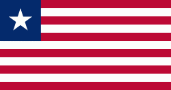
| Flag of Liberia | |
Liberia began in the early 19th century as a project of the American Colonization Society (ACS), which believed black people would face better chances for freedom and prosperity in Africa than in the United States. Between 1822 and the outbreak of the American Civil War in 1861, more than 15,000 freed and free-born African Americans, along with 3,198 Afro-Caribbeans, relocated to Liberia. Gradually developing an Americo-Liberian identity, the settlers carried their culture and tradition with them. Liberia declared independence on July 26, 1847, which the U.S. did not recognize until February 5, 1862.
Currency / Language
| ISO | Currency | Symbol | Significant figures |
|---|---|---|---|
| LRD | Liberian dollar | $ | 2 |
| ISO | Language |
|---|---|
| EN | English language |