Montserrado County (Montserrado County)
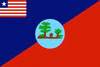 |
Created in 1847 at the foundation of the country, the county is the oldest in Liberia. Montserrado’s County Superintendent is Nyenekon Beauty Snoh-Barcon. The county is bordered by Bomi County to the west, Bong County to the north, and Margibi County to the east. The southern part of Montserrado lies on the Atlantic Coast.
Located on the coast in the northwestern third of Liberia, Montserrado County is bordered by three counties. The Atlantic Ocean makes up the county’s southern border, while Bomi County lies on the western border. Bong County is to the north and Margibi County to the east. The land is mainly alluvial soils, primarily clay, washed seaward from the streams and rivers of the interior valleys. In the lowlands on the coast grow palm trees, mangrove woods, and savanna grasslands with tropical forest covering the interior hills and valleys. Rivers include the St. Paul, Mesurado, Du, and Po.
The climate is tropical with dry and wet seasons. Annual precipitation measures approximately 75 in. From May to November is the rainy season, followed by the dry season from December through April. During the dry season winds from the Sahara Desert called the Harmattan create wild temperature fluctuations from December to the beginning of March.
Map - Montserrado County (Montserrado County)
Map


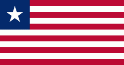
Country - Liberia
 |
 |
| Flag of Liberia | |
Liberia began in the early 19th century as a project of the American Colonization Society (ACS), which believed black people would face better chances for freedom and prosperity in Africa than in the United States. Between 1822 and the outbreak of the American Civil War in 1861, more than 15,000 freed and free-born African Americans, along with 3,198 Afro-Caribbeans, relocated to Liberia. Gradually developing an Americo-Liberian identity, the settlers carried their culture and tradition with them. Liberia declared independence on July 26, 1847, which the U.S. did not recognize until February 5, 1862.
Currency / Language
| ISO | Currency | Symbol | Significant figures |
|---|---|---|---|
| LRD | Liberian dollar | $ | 2 |
| ISO | Language |
|---|---|
| EN | English language |