Artibonite Department (Département de l'Artibonite)
Artibonite (French) or Latibonit (Haitian Creole) is one of the ten departments of Haiti located in central Haiti. With an area of 4,887 km2 it is Haiti's largest department. As of 2015, its estimated population was 1,727,524. The region is the country's main rice-growing area. The main cities are Gonaïves (the capital) and Saint-Marc. In February 2004 an insurgency tried unsuccessfully to declare Artibonite's independence.
The name L'Artibonite is derived from the Artibonite River the longest river on the Quisqueya island. L'Artibonite is derived from the Taino word Ja'tibonicu' meaning The Great High Place of the Sacred Waters. Under Toussaint's administration of the island, the department was known as Toussaint's Department.
The name L'Artibonite is derived from the Artibonite River the longest river on the Quisqueya island. L'Artibonite is derived from the Taino word Ja'tibonicu' meaning The Great High Place of the Sacred Waters. Under Toussaint's administration of the island, the department was known as Toussaint's Department.
Map - Artibonite Department (Département de l'Artibonite)
Map


Country - Haiti
 |
 |
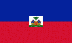
| Flag of Haiti | |
The island was originally inhabited by the indigenous Taíno people, who originated in South America. The first Europeans arrived on 5 December 1492 during the first voyage of Christopher Columbus, who initially believed he had found India or China. Columbus subsequently founded the first European settlement in the Americas, La Navidad, on what is now the northeastern coast of Haiti. The island was claimed by Spain and named La Española, forming part of the Spanish Empire until the early 17th century. However, competing claims and settlements by the French led to the western portion of the island being ceded to France in 1697, which was subsequently named Saint-Domingue. French colonists established lucrative sugarcane plantations, worked by vast numbers of slaves brought from Africa, which made the colony one of the richest in the world.
Currency / Language
| ISO | Currency | Symbol | Significant figures |
|---|---|---|---|
| HTG | Haitian gourde | G | 2 |
| USD | United States dollar | $ | 2 |
| ISO | Language |
|---|---|
| FR | French language |
| HT | Haitian Creole language |