Annobón Province (Provincia de Annobón)
Annobón (Provincia de Annobón; Ano-Bom), and formerly as Anno Bom and Annabona, is a province (smallest province in both area and population) of Equatorial Guinea consisting of the island of Annobón, formerly also Pigalu and Pagalu, and its associated islets in the Gulf of Guinea. According to the 2015 census, Annobón had 5,314 inhabitants, a small population increase from the 5,008 registered by the 2001 census. The official language is Spanish but most of the inhabitants speak a creole form of Portuguese. The island's main industries are fishing and forestry.
Annobón is the only island of the country located in the Southern Hemisphere of the Atlantic Ocean. The provincial capital is San Antonio de Palé on the north side of the island; the other town is Mabana, formerly known as San Pedro. The roadstead is relatively safe, and some passing vessels take advantage of it in order to obtain water and fresh provisions, of which Annobón has offered an abundant supply. However, there is no regular shipping service to the rest of Equatorial Guinea, and ships call as infrequently as every few months.
Annobón derives its name from Ano Bom ( lit. "Good Year"). It was named for the date of its discovery by the Portuguese on New Year's Day (Dia do Ano Bom) in 1473.
During the final years of the Francisco Macías Nguema administration, the island was called Pigalu and Pagalu, from the Portuguese papagaio (parrot). In Spanish it is known as the Provincia de Annobón (Province of Annobón).
Map - Annobón Province (Provincia de Annobón)
Map
Country - Equatorial_Guinea
 |
 |
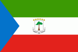
| Flag of Equatorial Guinea | |
Equatorial Guinea consists of two parts, an insular and a mainland region. The insular region consists of the islands of Bioko (formerly Fernando Pó) in the Gulf of Guinea and Annobón, a small volcanic island which is the only part of the country south of the equator. Bioko Island is the northernmost part of Equatorial Guinea and is the site of the country's capital, Malabo. The Portuguese-speaking island nation of São Tomé and Príncipe is located between Bioko and Annobón. The mainland region, Río Muni, is bordered by Cameroon on the north and Gabon on the south and east. It is the location of Bata, Equatorial Guinea's largest city, and Ciudad de la Paz, the country's planned future capital. Rio Muni also includes several small offshore islands, such as Corisco, Elobey Grande, and Elobey Chico. The country is a member of the African Union, Francophonie, OPEC and the CPLP.
Currency / Language
| ISO | Currency | Symbol | Significant figures |
|---|---|---|---|
| XAF | Central African CFA franc | Fr | 0 |
| ISO | Language |
|---|---|
| FR | French language |
| ES | Spanish language |


